Winter Weather Finally Arrives in Spain
Winter Weather to Finally Grace Spain Following an Unusually Warm November
After enduring nearly nine months of persistent heat and balmy conditions, Spain is bracing itself for a welcome shift in the weather.
A sweeping cold front is poised to sweep across the nation, ushering in chilly polar winds, dramatic temperature plunges, and even a dusting of snow in the mountainous regions.
It appeared as though summer’s grasp would never loosen on Spain, with scorching heatwaves extending well into September. November, too, was uncharacteristically warm, prolonging the sense of an endless summer, with the added bonus of the “Veranillo de San Martín” or Indian summer.

However, winter’s long-awaited arrival is now imminent, accompanied by a formidable cold snap and Arctic winds. Commencing on Monday, November 20th, meteorologists are forecasting the arrival of frigid polar air from the North Atlantic. This incursion of cold air will give rise to mountain snowfall, frosts, and robust winds.
Rubén del Campo, spokesperson for the State Meteorological Agency (AEMET), elucidated the phenomenon as “a corridor of cold winds from the north.” This influx of polar air will result in a remarkably abrupt drop in temperatures, with daytime variations of approximately 10 to 12 degrees Celsius less. In some regions, the mercury could plummet below freezing, resulting in snowfall in areas such as the Cantabrian slopes and the Pyrenees, as predicted by weather experts from the Meteored forecasting platform.
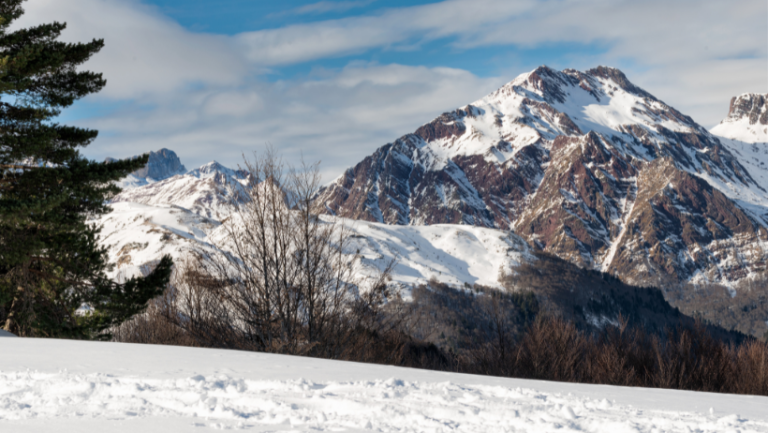
The most pronounced effects will be observed in the eastern half of the Iberian Peninsula and along the Mediterranean coastline. While the majority of Spain is expected to remain dry during the week, precipitation is anticipated along the Cantabrian coast, the Pyrenees, northeastern Catalonia, and the Balearic Islands. Cities like San Sebastián, Santander, and Gijón may see accumulations of 20 to 40 liters per square meter.
Between Monday and Wednesday, strong north and northwest winds are also expected to buffet the Cantabrian Sea, northern Catalonia, the Ebro Valley, and the Balearic Islands. Wind gusts could exceed 100 kilometers per hour in the Pyrenees and around Cap de Creus, Spain’s easternmost point.
AEMET notes that temperatures will take on a distinctly wintry character from mid-week onward. On Tuesday, November 21st, several provincial capitals in the northern half of the peninsula are forecasted to barely reach 10 degrees Celsius during the daytime. Cities like Ávila, Segovia, Soria, and Burgos are expected to remain between 7 and 8 degrees Celsius at most. Similarly, Vitoria i Gasteiz, Logroño, and Pamplona will experience maximum temperatures ranging from 8 to 10 degrees Celsius, while Madrid and Toledo will register between 11 and 13 degrees Celsius.
In the Pyrenees, temperatures are anticipated to plummet below -10 degrees Celsius, and areas in Aragón will also dip below freezing. Cities such as Teruel, Cuenca, and Ávila could awaken on Thursday to thermometers registering a frosty -3 degrees Celsius.
The snow level is projected to hover between 1,300 and 1,500 meters on Monday, gradually descending to 1,000 meters or even lower by Thursday, in accordance with Meteored’s predictions.

Meanwhile, the Canary Islands will continue to bask in warmth, with maximum temperatures ranging between 25 and 28 degrees Celsius. On Thursday, temperatures of 20 degrees Celsius will be confined to the Canary Islands and southern Andalusia exclusively.
In the Canary Islands, there is also a possibility of rain on the westernmost islands, with potential accumulations of 20 to 30 liters per square meter.